file:Mechi districts.png
Jump to navigation
Jump to search

Ii preview ke size: 776 × 600 pixels Duusra resolutions: 311 × 240 pixels | 621 × 480 pixels | 994 × 768 pixels | 1,056 × 816 pixels
Original file (1,056 × 816 pixel, file ke size: 34 KB, MIME type: image/png)
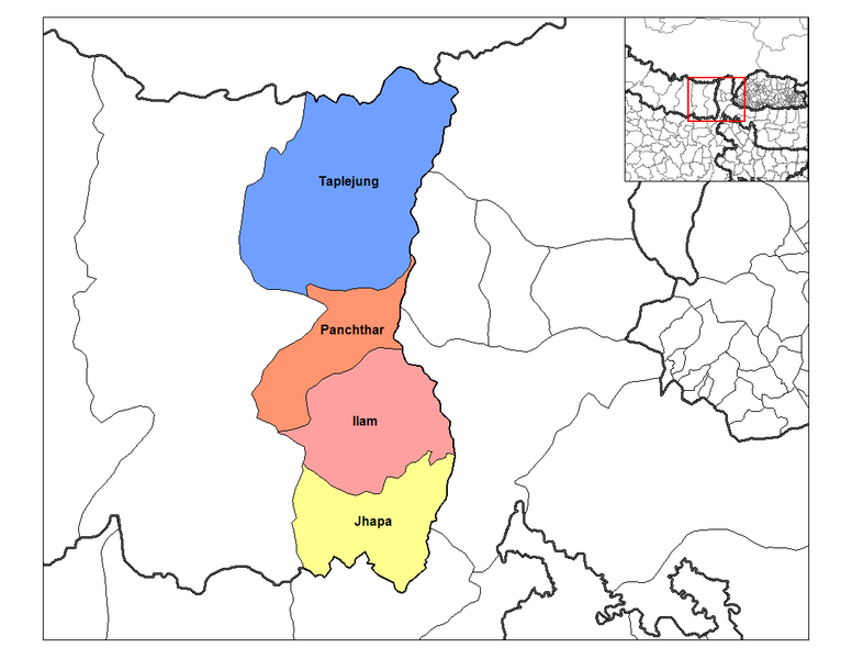
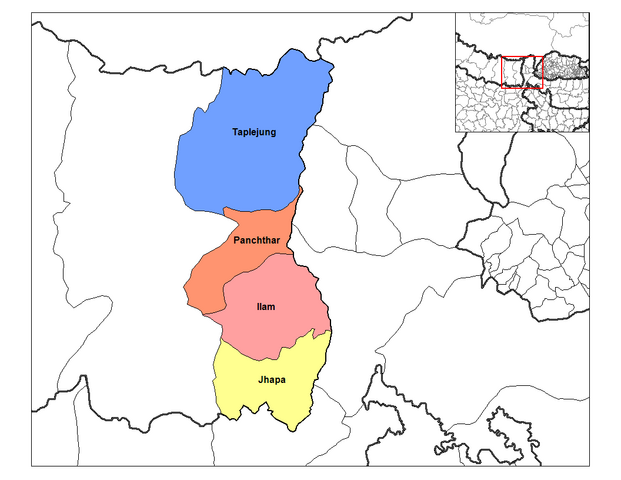
| Baare me | Map of the districts of Mechi Zone (wp-EN) in Nepal. Created by Rarelibra 19:32, 18 September 2006 (UTC) for public domain use, using MapInfo Professional v8.5 and various mapping resources. | ||
| Taarik | 18 Saptambar 2006 (original upload date) | ||
| Source | Transferred from en.wikipedia to Commons. | ||
| Likhe waala | The original uploader was Rarelibra at English Wikipedia. | ||
| Adhikaar (Ii file ke fir se kaam me laawa jaae hai) |
|
Original upload log
The original description page was here. All following user names refer to en.wikipedia.
- 2006-09-18 19:32 Rarelibra 1056×816×8 (35157 bytes) Map of the districts of Mechi zone in Nepal. Created by ~~~~ for public domain use, using MapInfo Professional v8.5 and various mapping resources.
File ke itihaas
File ke dekhe khatir, jaise uu time dekhe me lagat rahaa, date/time pe click karo.
| Din/Time | Chhota chapa | Lambai aur chaurai | Sadasya | Tiprrin | |
|---|---|---|---|---|---|
| abhi waala | 22:42, 9 Aprel 2007 | | 1,056 × 816 (34 KB) | wikimediacommons>Hégésippe Cormier | {{Information |Description=Map of the districts of '''Mechi Zone''' (wp-EN) in Nepal. Created by Rarelibra 19:32, 18 September 2006 (UTC) for public domain use, using MapInfo Professional v8.5 and |